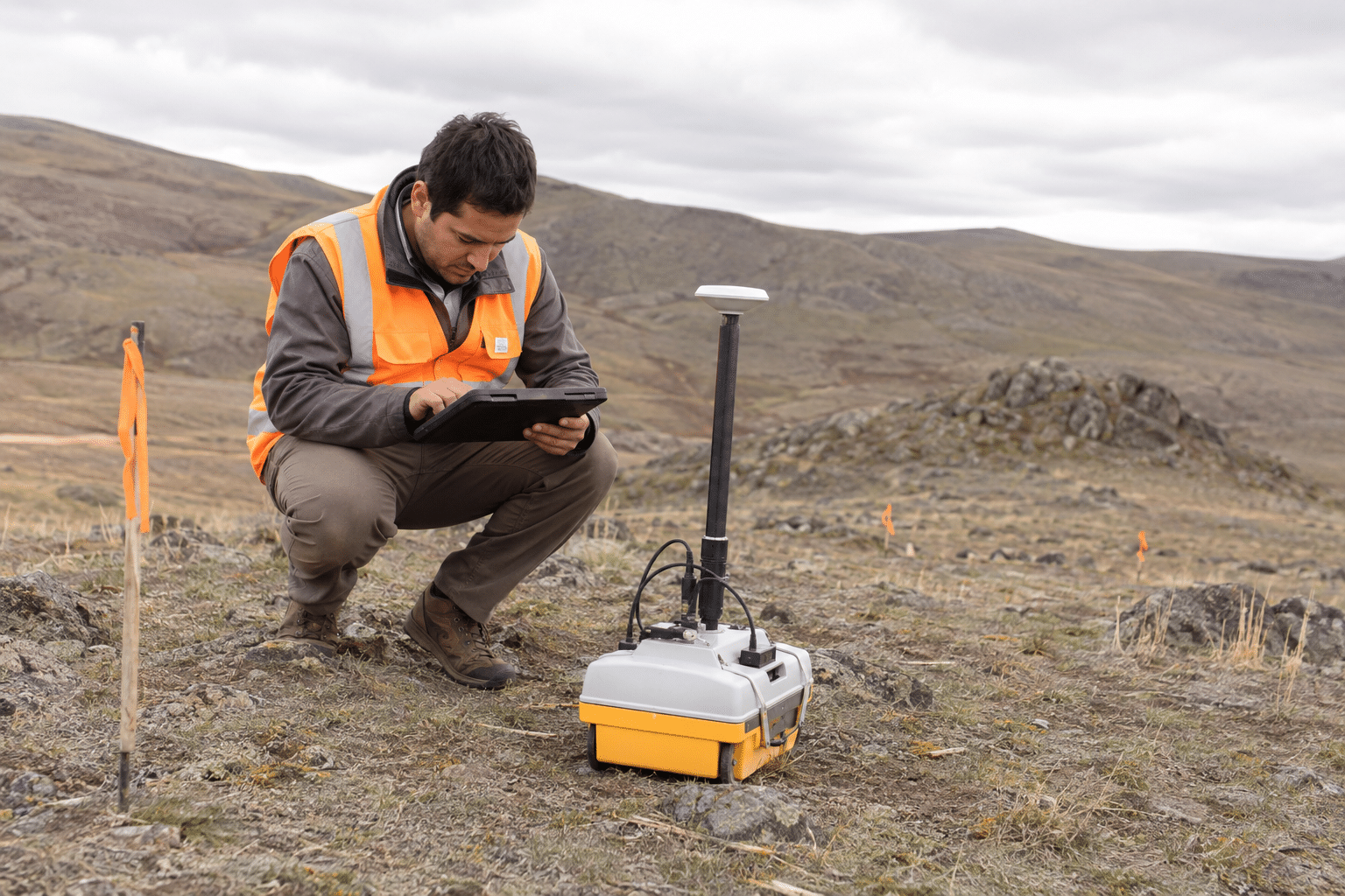
A geophysical technician supports surveys that measure conditions below or around the ground. The work may help locate buried features, understand site conditions, monitor changes, or support engineering and environmental decisions. It combines equipment setup, field logistics, data quality checks, and careful records, so the job is as much about reliable measurements as it is about operating instruments.
What does a geophysical technician do?
Typical duties may include:
- Setting up and checking sensors, cables, electrodes, receivers, or other survey equipment.
- Collecting readings across a planned grid, transect, borehole, or project site.
- Recording coordinates, weather, site conditions, instrument settings, and quality checks.
- Downloading, organizing, and reviewing data for missing or suspicious readings.
- Helping maintain equipment and troubleshoot basic field problems.
- Preparing maps, charts, field logs, and data packages for a geophysicist or engineer.
Common methods include electrical resistivity, electromagnetic surveys, ground-penetrating radar, seismic methods, and magnetic surveys. A technician may work outdoors for long periods, then spend time indoors cleaning data and preparing the next field deployment.
Training and education
Many employers look for an associate degree, certificate, or relevant technical experience in geophysics, geology, earth science, surveying, electronics, environmental science, or engineering technology. The right entry point depends on the equipment and the employer.
Useful preparation includes basic algebra, physics, map reading, GPS, spreadsheets, data quality control, and safe equipment handling. GIS can help when field measurements need to be placed on maps. Experience with cables, batteries, sensors, or instrumentation can also transfer well from other technical jobs.
Formal licensing is not usually the central requirement for technician work, but the supervising professional may have licensing obligations depending on the project and state. Always check the actual job posting and the rules that apply to the work being performed.
Pay and job outlook
BLS reported 2025 median pay of $53,350 for geological technicians and $64,790 for hydrologic technicians. Those figures provide a broad benchmark for related technician work; they are not a specific national salary for every geophysical technician. Pay varies with method, travel, industry, overtime, and the technician’s ability to manage field data independently.
BLS projects 2% growth for geological and hydrologic technicians from 2025 to 2035 and about 1,400 openings per year across the combined occupations. Geophysical technicians are a narrower specialty, so the best indicator for a career changer is the number and type of openings in the region where they can work.
Could this career fit you after 35?
This path may fit someone who likes instruments, maps, problem-solving, and a mix of field and computer work. It can be appealing if you want a technical role connected to science and infrastructure without starting as a lead geophysicist.
The practical demands are real. Field days may mean driving to remote sites, carrying equipment, working around traffic or construction, and handling heat, cold, mud, or uneven terrain. Data work requires patience because a small recording error can affect the interpretation of an entire survey. Ask about travel, overnight work, lifting requirements, and how much training is provided.
How to prepare for the first job
- Read local postings and identify the methods and instruments employers mention most often.
- Build a small practice portfolio with a mapped field exercise, spreadsheet, or data-quality example.
- Learn basic GIS and GPS workflows, along with safe battery and cable handling.
- Look for field assistant, survey assistant, environmental, or geotechnical technician positions.
- Ask prospective employers how technicians advance into data processing, specialist methods, or project coordination.
You can compare this route with geotechnical technician, GIS technician, and surveying technician careers.
What an instrument measures
A geophysical survey gathers physical measurements that a specialist interprets in the context of the site. It does not directly produce a complete picture of everything underground. The USGS describes several methods because different measurements respond to different properties. A technician needs to understand the purpose of the assigned survey well enough to collect usable data and recognize a collection problem.
For a job seeker, the method matters more than the broad title. A vacancy involving ground-penetrating radar differs from one centered on seismic equipment or resistivity surveys. Ask which instruments the team uses most often and whether new staff learn one method first. Familiarity with electronics can help, but it does not replace instruction in the survey method.
Position and settings travel with the measurement
Consider an illustrative survey line with an unexpected reading. The processing team needs to know where that reading was collected, how the equipment was configured and whether conditions changed nearby. A number separated from its position or field notes may be difficult to assess. Technicians protect that connection through consistent identifiers and the project’s recording procedure.
Equipment checks and repeat observations may form part of the survey plan. Learn what the team considers acceptable data and how to flag a questionable reading. Quietly deleting an unusual value would remove information the interpreter may need. The technician’s task is to document the issue and follow the review process, not make the final interpretation look tidier.
A field day continues after collection
Downloading files, checking that they are complete and preserving the original observations are part of the assignment. Ask how the employer names survey lines and separates raw files from processed outputs. A usable handover includes enough context for someone who was not on site to understand what happened.
This is a practical area where a career changer can demonstrate skill. Create an educational dataset with positions, timestamps and a short field log. Introduce a clearly labeled missing observation and explain how you would flag it. Such an exercise shows attention to data quality without claiming to have performed a professional geophysical investigation.
Distinguish nearby earth-science jobs
Geology technicians may focus on specimens and geological records. Geotechnical technicians often support investigations or tests for construction. Geophysical technicians concentrate on measurements from survey instruments and the data those instruments produce. Employers can combine duties, but these differences help you decide which vacancy matches your interests.
If you enjoy handling physical samples more than preparing instruments, a geology laboratory may be a better starting point. If mapping measurements and finding collection errors appeals to you, geophysical field support deserves a closer look. Ask to see an anonymized example of the output a technician hands to the project scientist.
Assess the deployment pattern
Confirm how often crews stay away overnight, how equipment reaches the site and what happens when weather interrupts a survey. Travel allowances and paid travel time should be discussed directly rather than assumed from the salary. A local environmental consultancy and a travelling exploration crew can offer very different lives under the same title. Choose with that weekly reality in view.
Sources
- U.S. Geological Survey: Geophysical Methods
- U.S. Bureau of Labor Statistics: Geological and Hydrologic Technicians
- U.S. Bureau of Labor Statistics: Geoscientists
- OSHA: Construction Industry
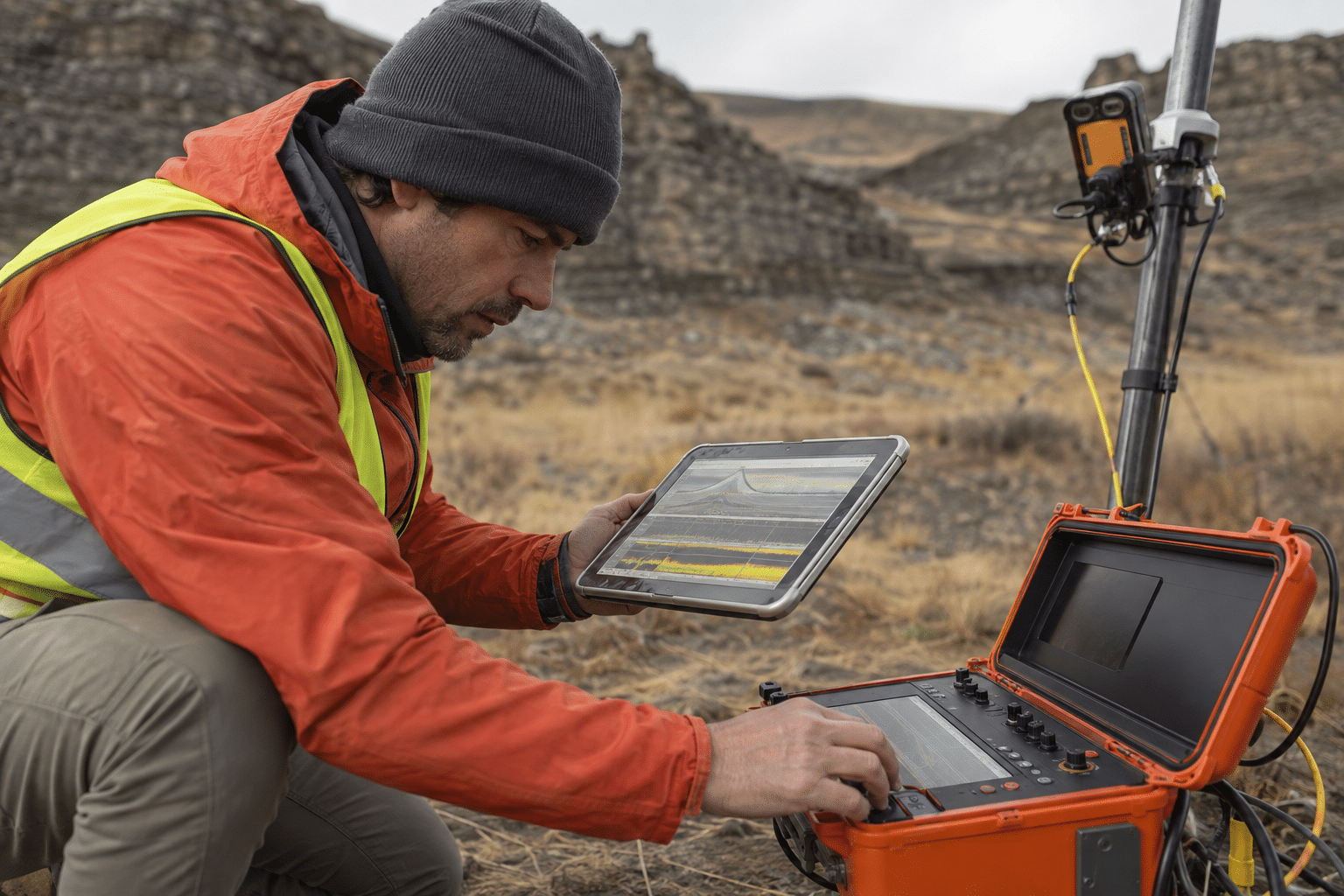
Field conditions can change the survey: Nearby vehicles, buried metal, wet ground, power lines, weather, or a damaged cable can affect the signal. The technician checks the equipment, notes the site conditions, repeats questionable readings, and tells the project lead when the data should not be treated as reliable.